
Trace a Decatur Street Address
A sound Decatur street search moves from geography to names. Start by checking the address in City OneMap or the county parcel viewer. A parcel is the mapped unit of land used by the tax and deed systems. The map settles the city-limit question and supplies the parcel ID, which is more stable than a typed street name. The appraisal card then identifies the assessed owner. A deed search can show how that owner acquired title, but neither source lists every person who lives there.
- Normalize the street number, name, and type in the county or city map, then confirm whether the parcel lies inside incorporated Decatur.
- Copy the parcel ID and open the DeKalb appraisal profile. Record the situs address and tax mailing address as separate facts.
- Click adjoining parcels or search nearby street numbers one at a time to build a verified street sequence.
- Carry the parcel ID, owner name, legal description, or deed book and page into Landmark Web to follow recorded title.
- For past occupants, inspect the correct historical city or suburban volume and compare it with census and newspaper evidence.
This sequence keeps the Decatur address search tied to official identifiers. It also prevents a postal Decatur address outside city limits from being sent to the wrong permit or records office.
Search Decatur Streets by Parcel
The DeKalb County Property Appraisal search is the strongest first index for a current address. It supports basic searches by parcel ID, address, or owner name, with separate paths for advanced sales and map work. A public parcel profile may contain current and past assessments, owner and mailing data, values, exemptions, characteristics, sales, and a sketch or photo when available.
| Search choice | Input | Best street-directory use | Caution |
|---|---|---|---|
| Parcel ID | County parcel key | Exact bridge among appraisal, GIS, taxes, and newer deeds | Keep the displayed spacing and punctuation |
| Address | Situs street address | Start with a known house or lot | Do not substitute the owner's mailing address |
| Owner Name | Person or entity | Locate parcels held by a known owner | Try name and business variants |
| Advanced/Sales | Portal controls | Review sale and assessment context | Available fields can change |
| Map Search | Map selection | Move from one lot to the next | A parcel is not a household roll |
The official interface is visible in this DeKalb property-search screen.
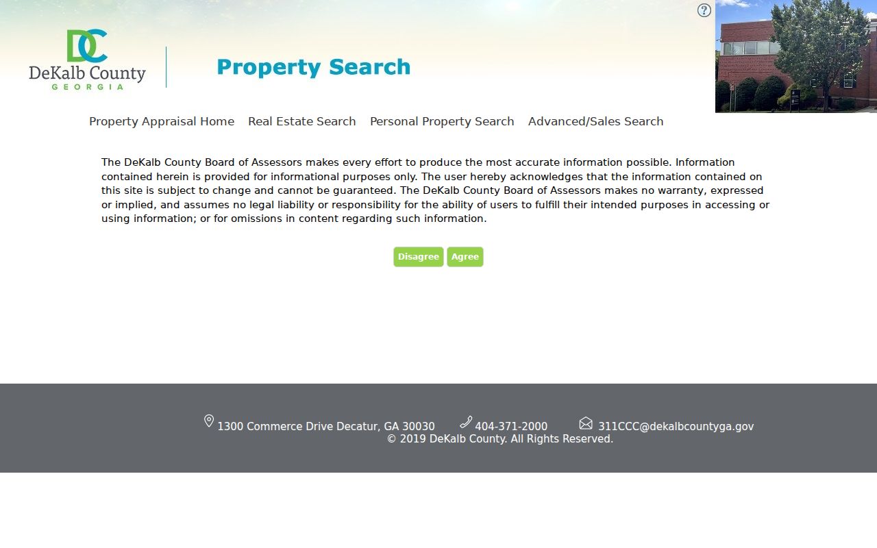
The captured search choices show why the parcel key is the cleanest link between an address and the rest of DeKalb's land-record trail.
Read Decatur Address Fields Carefully
A Decatur parcel card can show two addresses that answer different questions. The situs address is the physical site used by maps, permits, assessment, and emergency systems. The tax mailing address is where the owner receives correspondence. It may be a post office box, agent, fiduciary, or out-of-area destination. Matching situs and mailing addresses may support owner occupancy, but it does not prove it. A homestead exemption is also a useful clue, not a list of the household.
- Parcel
- A mapped unit of land with a county identifier that joins property systems.
- Situs address
- The physical location of the land or building, distinct from tax mail.
- Plat
- A recorded survey drawing that shows lots, boundaries, and subdivision details.
- Criss-cross directory
- A directory arranged by street and house number instead of surname.
Note: Copy each field under its own label, since treating a mailing address as the occupied home can send a Decatur search in the wrong direction.
Decatur Records Organized by Address
No single roll supplies a full by-street account. Each custodian records a narrow fact, and the records become useful when the parcel ID or exact address connects them. The appraisal and tax systems identify assessed ownership and mail destinations. GIS supplies parcel position and government layers. Deeds establish recorded transactions. City permit records date work at a site. Historical directories may name an occupant in a particular year.
| Address source | Decatur keeper | Evidence along a street | Access route |
|---|---|---|---|
| Appraisal roll | DeKalb Property Appraisal | Owner, situs, mailing address, parcel, values, characteristics | Free owner, address, or parcel search |
| Property tax roll | DeKalb Tax Commissioner | Tax account, owner, mail destination, payment status | Free web search |
| Parcel map | County GIS and City OneMap | Contiguous lots, city line, zoning, historic and hazard layers | Free map browse and parcel selection |
| Recorded instruments | Superior Court Clerk | Deeds, liens, plats, title parties, legal descriptions | Online from 1979; courthouse room for older books |
| City permits | Decatur DEC and Planning | Work chronology, applicants, and property contacts | Department contact or narrow open-records request |
| Old directories | Library and History Center | Named occupant at an address in a printed snapshot | Online run or in-person research |
The DeKalb property-tax account search is a separate official source from appraisal.
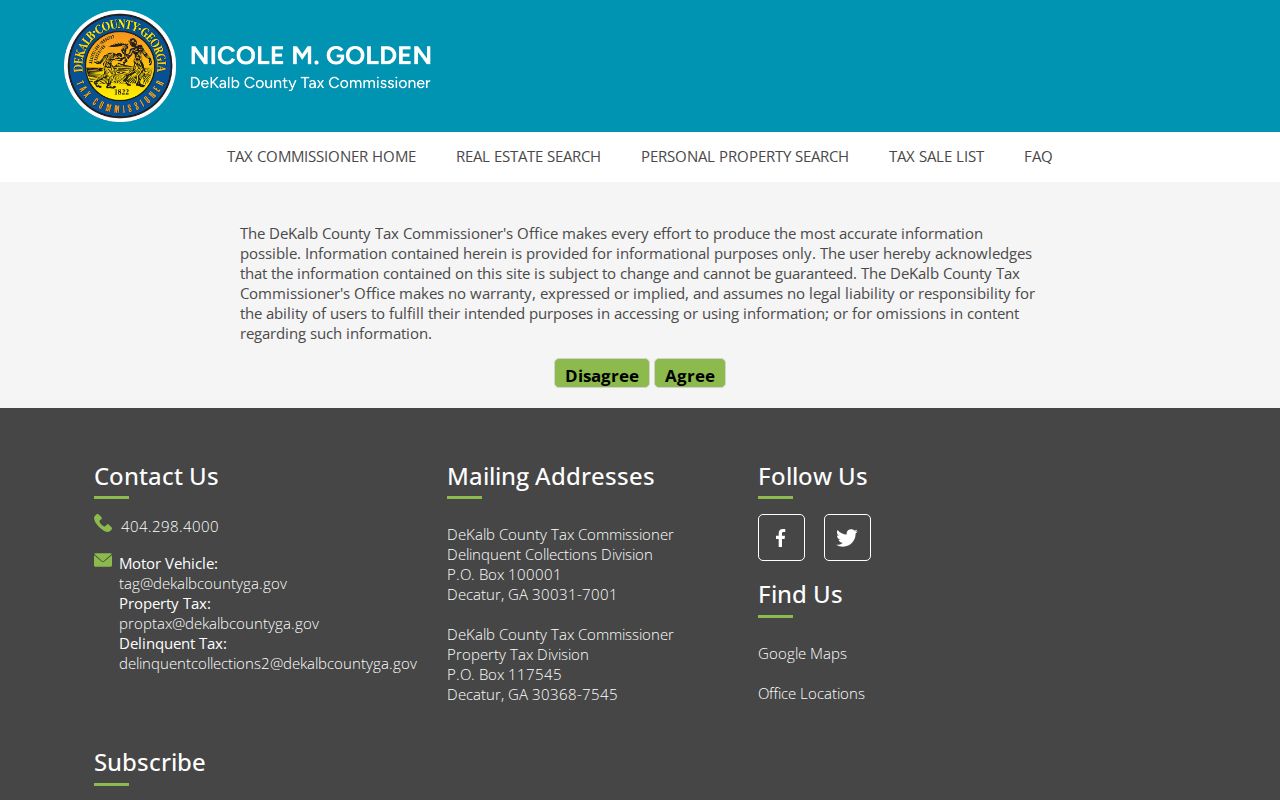
Its account view can corroborate ownership and mail data, but the Tax Commissioner, not GIS, is the office that verifies or updates a tax mailing address.
Map Decatur Streets Lot by Lot
The DeKalb GIS gateway and City of Decatur OneMap support the map-first side of a street directory. Search by address, place, or parcel ID, zoom until lot lines appear, and select one polygon at a time. Adjacent polygons provide a defensible way to walk a block. City OneMap also supplies city limits, zoning, local historic districts, stream buffers, and flood-hazard zones.
Jurisdiction matters here. A mailing line that says Decatur can fall outside the incorporated city. County GIS handles county addressing and plat review, while incorporated Decatur address changes and subdivision work go to City Planning. Use the city-limit layer before seeking a permit or code record. GIS shows land, not the people inside a home.
Carry Decatur Streets Into Deeds
The Landmark Web recorded-document index covers online information from 1979 to the present. It offers searches by party name, document and date, book/page, parcel ID, filing date, clerk file number, and legal terms. That range makes it possible to move from a parcel card to a deed, then from the current grantee, the person receiving title, back to the prior grantor, the person conveying it.
The street address may not be indexed on an older instrument. Search the parcel ID where present, then use book/page, subdivision, lot, block, land lot, and other legal-description terms. Landmark advises trying all name spellings. Its office does not research a document by telephone, but public computers and deputy assistance are available at the Real Estate Division in the DeKalb County Courthouse. Books reach back to 1842, so a chain that crosses the online cutoff continues at the public-access room, Georgia Archives microfilm, or other archival holdings.
The official modes appear on the Landmark search screen.
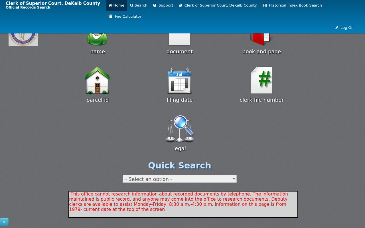
The image reinforces that a broad surname search is only one option; parcel, book/page, date, and legal searches often make a street chain far more precise.
Why Decatur Parcel Keys Matter
The Clerk reports processing more than 204,500 title-affecting documents, about 641,500 pages, each year. The division creates about 800 virtual deed books, cancels more than 26,500 mortgages, and enters over 82,000 cross-references. Those figures explain why an exact parcel, book/page, or short date range beats a loose name search in a busy county index.
Newer conveyances are easier to connect to a parcel because deeds of conveyance have had to show the DeKalb tax parcel ID on the first page since July 2019. That rule does not repair every older record. When an address or parcel ID changes after a lot split, combination, or replat, follow the recorded plat and legal description rather than assuming the land trail ended.
Note: The street directory should preserve instrument numbers and book-page references, since those keys let clerk staff retrieve the exact record without researching a name.
Resolve Lost Decatur Street Names
Current maps cannot by themselves prove that an old address has stayed the same. Decatur oral histories preserve useful leads: Andy Robertson recalled Clairemont's earlier name as Webster Street, while Clarence Scott described Marshall Street near downtown as a street whose old course was replaced by buildings and parking near the high-school stadium. These accounts identify a problem to test, not a dated legal change.
Resolve a vanished street through a directory's abbreviation and street guide, a Sanborn index map, commission minutes, recorded plats, and the legal description in a deed. Do not invent a citywide renumbering date. Parcel splits, lot combinations, and replats can also change the parcel ID even when the building appears to stay put. For the historical volumes themselves, use the Decatur city directory collection rather than treating a modern street search as a complete archive.
Date Decatur Property Changes
City permits can establish when construction, alteration, subdivision, or code activity touched an incorporated Decatur address. They may name an applicant, owner contact, or contractor, but they are not a roll of everyone who lived there. The reviewed research did not confirm an anonymous historical permit index with stable coverage. Start with the city's permit and inspection service index, then contact Decatur Design, Environment and Construction or Planning.
If the needed log is not online, submit a narrow request through the City of Decatur open-records channel. Name the department, address, record series, and date span. Ask for the existing permit index or file, not a newly compiled street list. The city can route active files under its records schedule, while older local material may have moved to the DeKalb History Center.
Find Past Decatur Street Occupants
Printed directories can add an occupant that land records omit. Before 1956, Decatur entries can appear in combined Atlanta city and suburban volumes. After the split, the suburban volume is the key Decatur shelf when the desired year exists. The DeKalb History Center also identifies a standalone 1928-29 Decatur and Avondale Estates directory. No verified local criss-cross year run was found, so ask whether the physical target volume contains a street guide before promising address-order access.
Search the exact street and number, record initials, spouse and widow notations, occupation, and residence codes, then compare the nearest available years. The Decatur Library genealogy collection adds directory material, Atlanta and local newspaper microfilm, state census sources, and reference help. Directory evidence is a dated snapshot and may omit boarders, renters, or people who chose not to list.
Limits of Decatur Street Records
A Decatur street directory built from official records cannot reveal a complete household. Deeds name title parties. Appraisal and tax rolls identify assessed owners. Parcel maps show land boundaries. Permits describe property work. None is a current census of renters, relatives, guests, or other occupants. Georgia's My Voter Page is an individualized verification tool, not a public browse-by-street directory, and protected voter addresses remain outside lawful street research.
Driver and utility customer details are not substitutes for missing household data. A blank portal result may reflect a city-limit error, spelling variant, changed parcel, archive cutoff, or protected field. Confirm the source and its coverage instead of treating silence as proof.
Lawful use. Use Decatur address records for family history, property research, civic questions, or personal safety. Never use them to stalk, harass, intimidate, or evade an address-protection program.