
Decatur ZIP Coverage
Decatur has a compact incorporated city and a much wider postal identity. ZIP 30030 is the main street-delivery ZIP for the city core. ZIP 30031 is used for Decatur post office boxes, including the city's own mailing address, and should not be treated as a residential neighborhood. The other ZIPs below use Decatur as a postal name but are largely or wholly outside the city. Parcel-level checking remains necessary near any edge.
| ZIP | Area relationship | Postal role | Key note |
|---|---|---|---|
| 30030 | Downtown, Oakhurst, and most incorporated neighborhoods | Decatur main street-delivery area | Verify city limits parcel by parcel near edges |
| 30031 | Decatur post office boxes | PO-box mailing ZIP | Do not map as a residential district |
| 30033 | North and northeast postal Decatur, near North Decatur and Emory | Decatur-associated routing | Largely outside incorporated Decatur |
| 30032 | East and southeast postal Decatur | Decatur facility and routing | Largely unincorporated DeKalb County |
| 30034 | South DeKalb postal Decatur | Street-delivery postal area | Outside incorporated Decatur |
| 30035 | East-central DeKalb postal Decatur | Street-delivery postal area | Outside incorporated Decatur |
| 30036 and 30037 | Special or PO-box routing tied to postal Decatur | Routed through Decatur labeling | Confirm current classification with USPS |
An honest Decatur postal directory keeps city-serving ZIPs separate from the broader set of postal-name ZIPs. It also avoids attaching neighborhood populations to mail routes. Census postal tabulation areas approximate mail geography, but they still are not city boundaries.
Postal Decatur Is Larger
A Decatur mailing line does not establish City of Decatur jurisdiction. The city counted 29,367 residents in about four square miles in the 2020 census, while postal Decatur reaches far beyond that municipal footprint. This matters because the right keeper changes. City Hall holds incorporated-city permits and municipal records. DeKalb County keeps parcel, deed, court, and county records. State agencies keep statewide rolls and vital records.
Check jurisdiction before sending a request. A resident in 30032, 30033, 30034, or 30035 may use Decatur for mail while living in unincorporated DeKalb. The word on the envelope is not enough to choose a police, permit, code, or election office. This geography quirk is the central limit of any Decatur postal search.
Boundary check. USPS confirms mailing data. City OneMap and county GIS confirm whether a parcel lies inside incorporated Decatur.
Verify a Decatur ZIP
Use the USPS address tool for one complete street address. Postal verification answers whether the address is deliverable and which ZIP belongs to it. It does not decide the city limit, tax district, zoning, or records custodian. Enter the street number, name, type, city, and state as accurately as possible, then keep the standardized result for the next map search.
Open the USPS ZIP lookup by address.
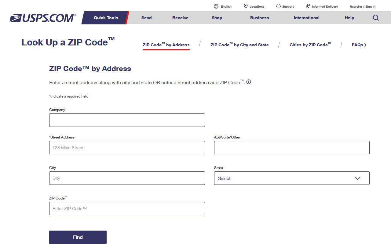
The USPS form is the official starting point for a specific address, not a list of all residents within a ZIP.
| Input | How to use it |
|---|---|
| Street address | Use a full house number, street name, and street type. |
| City and state | Enter Decatur, Georgia when that is the postal line being tested. |
| ZIP result | Carry the standardized ZIP into parcel and jurisdiction checks. |
| ZIP+4 | Use the added four digits for finer delivery routing when supplied. |
Find Decatur Residents by ZIP
No reviewed local public portal offered a verified browse-all-residents ZIP filter. The DeKalb assessor documents parcel ID, address, and owner-name searches. GIS accepts an address, place, or parcel ID. Landmark searches names, document data, book and page, parcel, dates, instrument number, and legal terms. My Voter Page checks one person's registration through identity inputs. None should be described as a public ZIP-wide resident roll.
- Verify the full address and assigned ZIP through USPS.
- Search that standardized address in City OneMap or the county parcel viewer.
- Confirm the city-limit layer, parcel ID, and physical address before opening a tax or appraisal record.
- Use the owner name or parcel ID in the official source that answers the actual question.
- Repeat for individual addresses only when there is a lawful, personal reason to do so.
Once a ZIP has narrowed the area to a named road, the Decatur street directory gives the address-by-address parcel method. That workflow is more defensible than treating a postal code as a list of households.
Map Decatur ZIP Addresses
County GIS tells users to search with a street number, street name, and street type. The parcel viewer then links the address to a polygon and parcel ID. City OneMap can search an address, place, or parcel and show city limits, zoning, local historic districts, stream buffers, and flood-hazard zones. These layers explain which government boundary applies after USPS supplies the postal answer.
Review DeKalb County GIS services.
The county source shows why mapping is a separate step from looking up a ZIP.
County GIS does not manage address changes, plat updates, or land-development status inside incorporated Decatur. Those issues go to city planning. County GIS still supplies parcel IDs and county mapping after an approved plat is recorded. Both offices matter, but their tasks differ.
Decatur Address Assignment
Inside the city, Decatur planning and engineering handle permanent address assignment for subdivisions. The senior engineer places addresses on the final plat and later issues a permanent address letter. The approved plat is recorded with the DeKalb Clerk. County GIS then creates or updates parcel IDs, and those IDs return to the city file. A mail ZIP is only one part of that chain.
See the county addressing and plat review division.
The division's guidance helps separate county parcel work from address decisions that belong to Decatur.
Decatur ZIP and Record Custody
A postal code does not assign a records custodian. The record's creator does. Deeds and plats go to the DeKalb Clerk of Superior Court. Parcel appraisal belongs to DeKalb Property Appraisal. Incorporated-city permits and municipal records belong to Decatur. Voter registration and court files follow their own county and state systems. Postal routing cannot move one record series from one office to another.
- Use USPS for delivery and ZIP verification.
- Use OneMap or county GIS for municipal limits and parcels.
- Use City of Decatur offices for records the city created or received.
- Use DeKalb County offices for county deeds, taxes, courts, and appraisal.
- Use Georgia agencies for statewide voter and vital-record channels.
When the desired record is not online, submit a narrow Georgia Open Records Act request to the office that holds it. Ask for an existing record series or index. An agency does not have to build a new list of residents by ZIP.
Decatur ZIPs Versus City Limits
ZIP boundaries are built for mail delivery and can cross municipal lines. City boundaries are legal limits used for government powers and services. A ZIP may include many carrier routes, and those routes can change without a city annexation. Conversely, a subdivision approval or lot combination may change parcel IDs and addresses while the postal ZIP stays the same. Historical searches need the dated plat, legal description, directory key, or map that was current at the time.
No official source reviewed supplied a complete dated Decatur ZIP split, street-renumbering, or annexation concordance. Do not invent one. If an old address disappears, compare contemporary directories, Sanborn maps, recorded plats, and legal descriptions. Oral history may explain a lead, but dated municipal and land records should prove the change.
- ZIP and ZIP+4
- A five-digit postal area and its four-digit delivery refinement. Neither is a city boundary.
- PO-box ZIP
- A code used for post office boxes, not a mapped residential neighborhood.
- Unique ZIP
- A ZIP assigned to one high-volume organization. No unique Decatur institution ZIP was verified here.
- Carrier route
- A postal delivery path within a ZIP. It is not a parcel, precinct, or neighborhood line.
What Decatur ZIPs Prove
A correct ZIP proves a postal routing fact for an address at the time of verification. It may help narrow a broad place search, distinguish a PO box from a physical site, or flag that a mailing address lies in the wider postal Decatur area. It does not prove that a named person currently lives there, that a parcel sits inside the city, or that a neighborhood and ZIP share the same edge.
Keep four address fields apart when saving a result. The situs address is the physical location used for maps, appraisal, permits, and emergency service. The tax mailing address is where the owner receives county correspondence and may point to a post office box, agent, or address outside Georgia. A legal description identifies the land through a subdivision, lot, block, land lot, or other recorded terms. The parcel ID is the county database key shared across appraisal, mapping, taxes, and many newer deeds. One field cannot safely stand in for another. A resident name linked only to a tax mailing address may identify an owner or fiduciary, not the person who occupies the Decatur parcel.
Keep the result in proportion. Confirm a person through the official roll made for that fact, and confirm the parcel through GIS. The Decatur postal directory is most useful as the first geography filter, followed by a source-specific search.
Note: A postal Decatur result should always be paired with a parcel-level city-limit check before choosing a municipal records office.